The upwelling index time series, used in this analytic tool, is provided by the Spanish Institute of
Oceanography (IEO - www.indicedeafloramiento.ieo.es).
The products shown are generated by the Marine Environment team of the Vigo Oceanografic Centre and the Ocean
Model team of the IEO/ La Coruña Oceanografic Centre, with support from the Oceanic Observatory of the Iberian
Shelf (RAIA) and RAIA co-projects.
Different data sources were used to calculate the Upwelling Index time series.
• Meteogalicia: Sea Level Pressure from the weather research and forecasting (WRF) atmospheric model.
• Fleet Numerical Meteorology and Oceanography Centre (FNMOC): Sea Level Pressure from the Global and Regional
Weather Prediction Charts (WXMAP) atmospheric model.
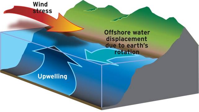
Upwelling is the rise to the surface of water, which is usually colder and richer in nutrients (nitrates,
silicates, phosphates). This water replaces the surface water pushed away by the wind. If the phenomenon occurs
along the coast, it is referred to as "coastal upwelling"; otherwise, it is referred to as "ocean upwelling".
Source: National Oceanic and Atmospheric Administration (NOAA)
Surface water is initially displaced by winds moving in the same direction. Some hours later, and owing to the
Earth's rotation, the surface layer is deflected to the right in the Northern Hemisphere and to the left in the
Southern Hemisphere (Coriolis effect).
In the Northern Hemisphere, coastal upwelling occurs when the wind blows along the coastline, with the coast to
the left of the wind's advance. In this case, as the surface layer moves offshore, subsurface water (typically
50-100 metres deep) rises along the coast. The colder, nutrient-rich water fertilizes the surface layers.
The displacement of surface waters caused by winds and deflected by the Coriolis effect is only effective to a
limited depth. The integrated flow between the ocean surface and this depth with "limited" motion, known as
Ekman transport, moves perpendicular to the wind direction (Ekman, 1905).
Bakun (1973), building on Ekman's (1905) previous research, described the "Upwelling Index." This index
estimates the amount of upwelled flow. This transport is determined by latitude and wind stress. The upwelling
index summarizes the oceanward flow of surface waters per kilometer of coastline (m3s-1 km-1), in the West-East
(Qx) and North-South (Qy) directions:
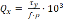
where τx, τy are the wind stress components estimated from the wind speed:
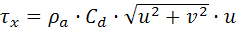
With f being the Coriolis factor, ρa and ρ the air and sea densities, respectively, Cd the
drag coefficient, u and v the wind speed components.
Lavín et al. (1991) used wind speed data from 1967 to calculate the daily Upwelling Index at 43ºN 11ºW,
indicating the intensity of upwelling along Spain's Western Galician coast. This estimate is still being used
today.
References:
Bakun, A., 1973. Coastal upwelling indices, west coast of North America, 1946-71. U.S.Dep. Commer., NOAA Tech.
Rep., NMFS SSRF-671, 103 p.
Ekman, V. W., 1905. On the influence of the earth’s rotation on the ocean currents. Arkiv for Mathematik,
Astronomi och Fysik, 2 (11), 52p.
Gonzalez-Nuevo, G. et al., 2014. Upwelling index: a powerful tool for marine research in the NW Iberian
upwelling system. Journal of Operational Oceanography, 7 (1), pp. 47-57. doi:10.1080/1755876X.2014.11020152
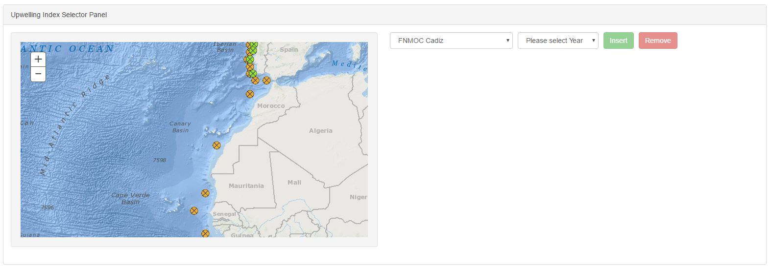
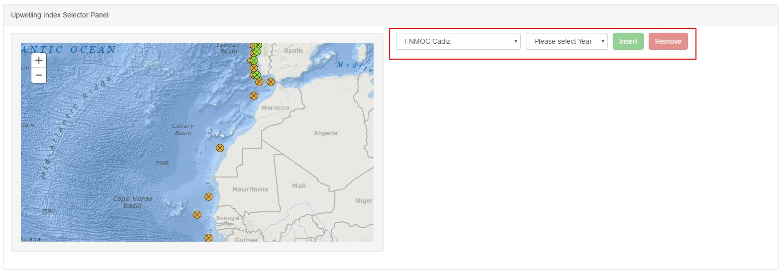
 allows to display the information contained in this popup.